

When a small aircraft vanishes over water, the first hours are governed by procedure, not speculation: search-and-rescue patterns spool up, cross-border coordination clicks into place, and investigators begin reconstructing a flight that ended not with a distress call but with silence.
At a Glance
- A PA-34 Piper Seneca with four people aboard departed Great Harbour Cay, Bahamas, for South Florida and lost contact roughly 13 miles west of Andros Island.
- Bahamian authorities requested U.S. Coast Guard support; joint air and maritime searches were launched across the likely track of flight.
- The aircraft’s disappearance fits a familiar general aviation profile: rare in absolute terms, but well understood in how agencies respond and investigate.
- Until wreckage is located and examined, “missing” describes an ongoing search; formal accident status and causes arrive only through investigation.
What is known about the missing flight
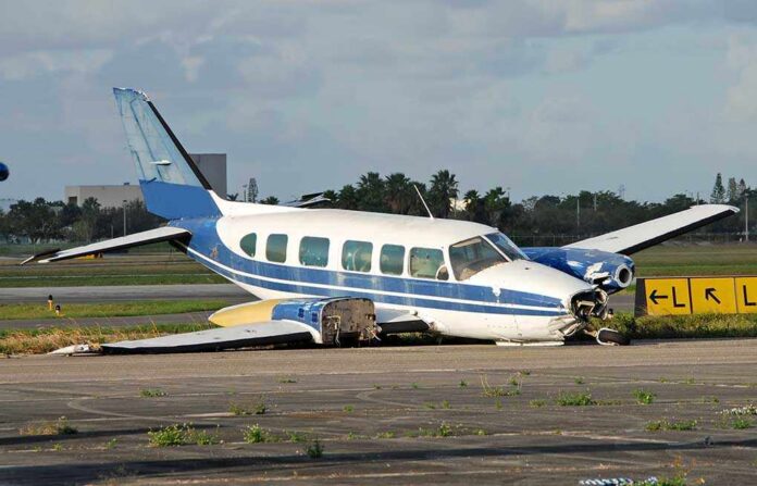
Authorities in the Bahamas reported that a PA-34 Piper Seneca, tail number N212ML, departed Great Harbour Cay late morning with four people aboard, bound for the Miami area. Air Traffic Control lost contact with the aircraft approximately 13 miles west of Andros Island, a stretch of water that funnels much of the light-aircraft traffic moving between the Berry Islands and South Florida. The Royal Bahamas Defence Force requested U.S. Coast Guard assistance at roughly mid-afternoon, triggering a coordinated search by air and sea assets across the aircraft’s projected route and drift areas derived from currents and wind at the time of disappearance.
Local and U.S. outlets have described the occupants as a Miami-area family—two grandparents traveling with two grandchildren—returning from a Bahamas vacation home. The multi-agency response has included fixed-wing and rotary aircraft, surface vessels, and search planning cells that fuse radar last-known-position data with meteorological and oceanographic inputs to define high-probability search boxes. Those parameters are refined as any debris, oil sheen, or electronic pings are confirmed or ruled out.
How authorities search when a general aviation aircraft goes missing over water
Overwater searches for light aircraft are built around a few constants. First, last known position is king: controllers, if they were in contact, will provide the last radar return and altitude; in some cases, ADS-B track data adds granularity. Second, absent a mayday, investigators model likely failure modes—power loss, spatial disorientation, or instrument/weather issues—and the glide range or rapid descent profiles associated with each. Third, current and wind drive drift calculations that quickly expand the search area beyond the point where a pilot lost contact. The Royal Bahamas Defence Force and the U.S. Coast Guard regularly run joint operations in this corridor; in practical terms that means shared comms plans, deconflicted airspace, and a common search management framework so aircraft, cutters, and small boats sweep methodically rather than redundantly.
Modern emergency locator transmitters (ELTs) improve odds but are not guarantees. Many general aviation aircraft still carry legacy 121.5 MHz units that do not trigger satellite alerts; even 406 MHz ELTs, which do, can fail to activate if impact forces are insufficient to trip them or if antennas are compromised at ditching. That reality keeps visual search patterns and debris verification central to early operations—tech augments the hunt, but doctrine still assumes the sea conceals evidence unless and until you look where physics says it should drift.
Why “missing” is a procedural status, not a conclusion
In aviation, the words carry weight. An aircraft becomes “missing” when an official search concludes without locating wreckage or survivors; while a search is active, agencies describe an overdue or unaccounted-for flight and focus on locating persons and evidence. The headlines often run ahead of that nuance. Investigative status matters because it frames what is responsibly knowable on timetable: only when debris is recovered can regulators confirm an accident, determine jurisdiction, and open a formal probe under international protocols like ICAO Annex 13, which prescribe how facts are gathered, analyzed, and—ultimately—how safety recommendations are made.
The Bahamas-to-Miami general aviation route has seen its share of overdue aircraft calls over the decades; each follows the same arc. Intense early search activity yields either survivors and wreckage—occasionally aided by life rafts and handheld radios—or, if days pass with negative results, a transition to an investigative phase that relies on radar data, maintenance logs, pilot records, and any recovered components for causal analysis. That sequence is not evasion; it is the discipline that turns mystery into lessons learned.
Risk, rarity, and the general aviation record
Small-aircraft disappearances in this corridor loom larger in imagination than in statistics. General aviation accident rates have steadily improved across the past decade thanks to training, technology, and culture change; 2024 recorded the lowest GA fatal accident rate since the FAA began its current tracking series in 2009. Even so, hundreds of GA accidents occur annually nationwide, and a subset of those happen over water where survivability and evidence recovery both get harder. The Bahamas archipelago sits just far enough from Florida’s shore that engine failures, fuel mismanagement, or weather misjudgments can be unforgiving—particularly in multi-engine piston aircraft, where asymmetric thrust after a failure can rapidly degrade controllability if airspeed and technique falter.
It is tempting to attribute any disappearance in this region to the sea’s folklore; investigators do not. They look for prosaic, fixable causes: maintenance quality, pilot currency and decision-making, weight-and-balance, fuel planning, and weather briefings. When the data support it, they also weigh survivability factors—restraints, flotation, and post-impact rescue timelines—because in many ditchings, what happens after the touchdown is the difference between a rescue story and a memorial service.
A South Florida family is asking for help finding their loved ones after a plane carrying four relatives went missing while flying from the Bahamas to the Miami area, prompting a multi-agency search effort involving the US Coast Guard. https://t.co/5jcrWcFzNe
— H24 News US (@h24news_us) September 8, 2026
What comes next if wreckage is found
If searchers recover debris traceable to this PA-34, the Aircraft Accident Investigation Authority (Bahamas) would lead, with technical participation from the U.S. National Transportation Safety Board under Annex 13, because the aircraft and occupants are U.S.-based. The work is methodical: document the wreckage field, map impact signatures, inspect engines and propellers for rotation evidence, and correlate physical findings with radar and any avionics data to reconstruct the last minutes of flight. Investigators then move upstream—maintenance records, service bulletins, and pilot qualifications—to test plausible chains of events against the physical record. That process is not fast; its virtue is that it yields findings sturdy enough to change behavior, equipment, or regulation where needed.
For families and the flying public, what matters
For loved ones awaiting word, the distinctions between alert notices, searches, and investigations feel academic. The system’s purpose, however, is concrete: mobilize quickly when a flight goes silent, comb with discipline, and, when the search ends, replace uncertainty with the clearest account the evidence allows. That is how agencies honor both the people aboard and the pilots who will fly the same route tomorrow. In the meantime, the most reliable updates will continue to come from the Royal Bahamas Defence Force, the U.S. Coast Guard, and, if wreckage is identified, the investigating authority—organizations that trade speed of rumor for the weight of verified fact.
Sources:
nypost.com, miamiherald.com, nbcmiami.com, tampabay.com, cbs12.com, abcnews.go.com, faa.gov